GIS DEPARTMENT |
 |
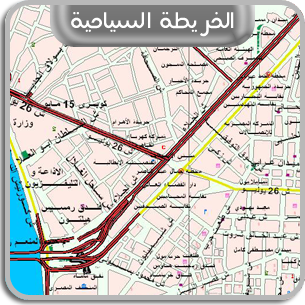
GIS Department is responsible for transferring digital data to paper copy that
is the map. GIS Department uses ARC/GIS program which is characterized by data
base & distinctive shape to produce maps.
|
|
|
TASKS OF GIS DEPARTMENT |
 |
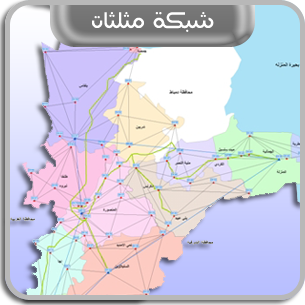
1 - Producing details maps of any region that include everything on the surface
of ground.
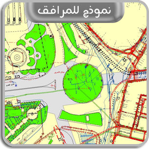
2 - Producing utilities maps for infra-structure of any region to recognize the
available underground utilities.
3 - Producing contour maps to recognize the ground levels in any region.
4 - Producing longitude & latitude sector maps.
5 - Calculating digging & filling up quantities.
6 - Making applications to facilitate going to anywhere.
7 - Making database to be suitable for the requirement of any project.
8 - Dealing with many resources of data (Excel - Access - JPG - ...... etc).
9 - Dealing with pictures by transforming them from raster to vector.
10 - Producing data in different forms as (Excel - Access - ...... etc).
11 - Cooperating in establishing utilities data centers in governorates
(Laliobia - Giza - Gharbia - ...... etc).
|
|
QUALIFICATION OF GIS DEPARTMENT PERSONNEL |
 |
There are unique surveying engineers & specialists in the field of GIS in the
department. Their number are more than (30) employees who have experience in
this field not less than (12) years.
|
|
ORGANIZATIONAL STRUCTURE OF GIS DEPARTMENT |
 |
The Department consists of GIS Department at the headquarter & GIS sections at
C.U.D.C.'s branches & the sections of the central Department are the following:
1 - Producing Maps Section:
It is specialized in producing projects that are outside Cairo Governorate.
Also, it accumulates database of Cairo Governorate from C.U.D.C.'s branches all
over Cairo Governorate.
2 - Technical Office Section:
It is specialized in preparing performance rates, raising the level of persons
technically by holding training courses as well as revising GIS works in
C.U.D.C.'s branches.
|
|
THE MOST IMPORTANT PROJECTS THAT GIS DEPARTMENT HAVE
PARTICIPATED IN
|
 |
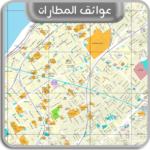
1 - Surveying the obstacles around Almaza Airport at Alexandria with a circle
its 15 k.m.
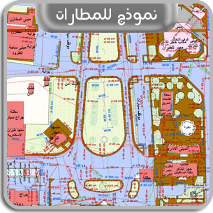
2 - Detailed surveying & detecting utilities of (18) airports in A.R.E.
3 - Detecting infra- structure utilities of Seidi Kerir station at Alexandriaas
well as West Cairo station.
4 - Cooperating in establishing utility data center at other governorates as
(Beni Sweif - Gharbia ------ etc)
|
|
|
|